|
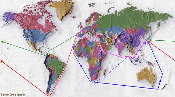
Sea shipment route via Panama Canal, to be used for 1998 waste shipment. Also used in 1984 for first plutonium shipment.
Distance: 12,156 nautical miles (19,563 km). |

|
Sea shipment route via Cape of Good Hope, used for the 1997 nuclear waste shipment from France to Japan. Also used in 1992 for plutonium
shipment (ship avoided Strait of Malacca in response to protests from
Indonesia and Malaysia [route shown with dotted line] and
went between Australia and New Zealand instead [solid line]).
Distance: 14,248 nautical miles (22,929 km). |

|
Sea shipment route used in 1995 to ship waste around Cape Horn.
Distance: 16,661 nautical miles (26,813 km). |

|
Sea shipment route via Suez Canal.
Distance: 10,899 nautical miles (17,540 km). Route not used to date.
|